Water Plan

Yellow Medicine One Watershed One Plan 2017-2026
The Yellow Medicine One Watershed One Plan (YM1W1P) was developed as one of five pilot "One Watershed One Plan" projects in Minnesota. The goal of the program is to allow counties to transition for count- based water management planning to watershed based planning. Ten local governments entered into a Memorandum of Agreement (MOA) to develop the YM1W1P. The mission of these organizations, along with the state agencies that cooperated in developing this plan, is to work together with citizens to restore and protect the water resources of the Yellow Medicine Watershed.
Memorandum of AgreementThis plan addresses three priority concerns: (1) mitigate altered hydrology and minimize flooding; (2) minimize the transport of sediment, excess nutrients, and bacteria; and (3) protect and preserve groundwater quantity and quality. These priorities were established as the result of an extensive process in which stakeholders identified their priority concerns and the potential threats to the resource if these three goals were not addressed. In addition, prioritizing implementation efforts was determined to be based on projects that offer multiple benefits and that are cost effective. It was also determined that implementation efforts that address mitigating altered hydrology and minimizing flooding will address the other priorities as well.
The full plan is available here.YM1W1P Planning Area and Subwatersheds
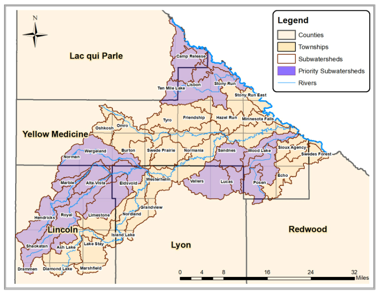
Click for Interactive Watershed Map
About the Yellow Medicine Watershed
The Yellow Medicine plan boundary, as approved by the BWSR, drains approximately 665,073 acres of primarily highly productive agricultural land in southwest Minnesota and includes nearly 1,700 miles of streams and ditches as well as 16,000 acres of lakes. The boundary for this project includes drainage to the Yellow Medicine River and several tributaries that drain directly to the Minnesota River. A defining feature in the project area is the Coteau des Prairies, which is a plateau that was left untouched by the glaciers that scraped and flattened much of the rest of Minnesota. The southeast portion of the Coteau des Prairies, partially located in the southwest of the Yellow Medicine Watershed, comprises one of the distinct regions in Minnesota, known as the Buffalo Ridge. From the Coteau region, the watershed drains to the northeast with 1,125 feet of elevation change to the lower region, called the Flatland region. The Transitional region in between these two regions is where the elevation changes are the greatest, at approximately 45 feet per mile. The drainage from the Coteau through the steep elevation change causes erosion in the Transitional region and flooding in the Flatlands. The topography in the Minnesota River Valley region is extreme with elevation changes of approximately 57 feet per mile.
Priority subwatersheds were selected to focus implementation efforts and maximize results. These subwatersheds were determined by using a combination of information generated from a calibrated Hydrologic Simulation Program-Fortran (HSPF) model and other factors including likelihood of success. The priority subwatersheds will change throughout the 10-year plan as progress is made and new opportunities arise.